Wayfaring in Western Wyoming
I didn’t need retrospection to know that a road trip across several states during a pandemic - months before the COVID-19 vaccines were even available - was a reckless idea. And yet, in October of 2020, I chose to go on one, driving from California up into western Wyoming, where I spent several days in the towns of Alpine, Jackson, and Pinedale.
I chose to do this because after months of staying indoors, virtual meetups, and deferred plans galore, I wanted a break. I was frustrated by the monotony of pandemic life, and I wanted to experience something new for once. An opportunity (or an excuse) presented itself in the form of my friends’ wedding in Denver. After a week of thinking about it, I confirmed my attendance. However, I wasn’t just going to Colorado; I decided to head up into Wyoming beforehand for a few days, as I had been planning for a Wyoming trip just weeks before California Governor Gavin Newsom issued a stay-at-home order on March 19.
Of course, I had to contend with the fact that the pandemic was (and still is) raging, so I developed personal guidelines that I would follow over the course of my road trip:
Wearing a mask whenever I entered a building, regardless of how many people were inside.
When outdoors, wearing a mask whenever people were within 20 feet of me.
No eating indoors at a restaurant. Any food I ordered would be eaten in my car, at a nearby park, or in the Airbnb stay or cabin I was staying at (which I had all to myself).
Using hand sanitizer any time I entered my car.
On the morning of October 10, I left California in a fully packed car, nervous yet excited for the times ahead.
Arrival: Alpine
It was well past 8:00pm on October 11 when I arrived in Alpine, where Highways 26 and 89 intersected, just miles away from the Idaho-Wyoming border. Ideally, I should have arrived at least two hours earlier so I could watch the sun set over the great Snake River as it runs into Idaho. However, I wasn’t upset; the experience of driving on a winding SH-34 in extreme darkness before reaching Highway 89 left me mentally drained and wanting only a soft bed. Perhaps I could have avoided this had I not gone on a long hike back in Antelope Island State Park in Utah… but that’s enough dwelling.
I pulled into a parking spot at Flying Saddle Resort and went into the lobby to check into my cabin. Minutes later, I had re-parked my car in the resort lot and was moving my essentials to my cabin. After settling in, I warmed up a microwavable “cup rice” with stir-fried kimchi for dinner and went to bed shortly after, wanting nothing more than a deep sleep.
Day One: Jackson
I was used to waking up early, and it was no different the next morning. There were a lot of things I wanted to do today, and I did not want to be delayed, whether by circumstance or my own doing. After closing the trunk of my car, I noticed a small pathway leading from the resort parking lot to a bench. Upon reaching the bench, I found myself facing the shallow waters of Snake River, with the river bank less than several yards under my feet. I took a moment to breathe in the clear Wyoming air and gaze upon the trees across the river, several yellow amidst the mostly green. It was supposed to be autumn, and I hoped that I arrived in time to see the fall colors reach their peak.


After checking out of my cabin, I drove east on Highway 26/89 toward Jackson, about 40 miles away. I ended up pulling over several times to get a good view of the river and its surroundings. Before the road started snaking north, I caught movement of a mule deer - a doe - moving into the brush. Luckily, it didn’t move in too deep in the time it took me to pull over, track back, and snap a photo.


After I got on Highway 191 (technically it merged with Highways 26/89), my first stop was at Jackson Hole Buffalo Meat Co., where they sell - you guessed it - buffalo meat. But I didn’t come here to buy steak, ribs, or patties, as the cabin which I was to stay at didn’t even have a kitchen; I was here simply for jerky to take home. I asked the salesperson for recommendations, and she recommended the buffalo and elk, noting that male customers seemed to prefer elk. I bought a pack apiece of buffalo pepperoni sticks and elk jerky. When tasting them a few weeks later, I found the buffalo pepperoni sticks to be well seasoned and juicy, while the elk jerky was too dry and tough.
At the time of my trip, much of Jackson’s streets, including the highway I was driving on, had construction going on, and this resulted in heavy traffic congestion. It took me a while to reach Jackson Town Square, which is easily recognized due to its arches made from elk antlers. I wanted to walk around the area, so I turned onto several streets until I found an available street parking spot.


First stop, Persephone Bakery. Located just down the street from the town square, this popular bakery had a line going out the front door, and it wasn’t even 11:00am yet. I was surprised yet pleased to see that everyone was wearing a mask, and it wasn’t until I reached the door that I saw a notice stating that Jackson Hole (which includes Jackson and several other surrounding towns) was requiring that everyone wear masks. It was a little tight inside, but people were at least trying to social distance and keep the line moving. I bought an apple croissant, a cheese scone, and a matcha latte. The bakery had outdoor seating, but people were a little too close together for my comfort, so I walked over to the town square and sat on a park bench to eat. This was my first meal of the day, and I found the pastries to be absolutely scrumptious and the drink perfect for this chilly day.


I saw the square’s antler arches when driving by, but I wanted to take a closer look. This square has not one, not two, but four of these arches, each one situated at its corners and drawing people in to take photos - though only one had been strewn with pink-purple lights. Even when looking at the arch up close, I was surprised at just how many antlers went into it. At the square’s center, there was a sculpture of cowboy Lewis Murray “Bud” Boller on a bucking horse. For a Monday, there were a lot of people about - not just in the square, but the whole town.

My next stop was the Vertical Harvest farm, which was a short walk away. This three-story greenhouse grows greens and tomatoes in a tightly controlled environment while using significantly less water. When researching it before my trip, I saw an older post on its Facebook page saying that it had closed its doors to the public due to the pandemic, so I was prepared for it to remain closed by the time I arrived. Still, it saddened me to see that indeed, it was closed. I could, however, catch a glimpse of their operations through a window - namely the plants being cycled vertically to receive light.
While walking back to my car, I swung by Pearl Street Market to buy a loaf of bread, as I had accidentally left my previous loaf at my Airbnb stay two nights before. I would then proceed to accidentally leave this loaf at another Airbnb stay one week later. Fool me twice…


If it wasn’t for the pandemic, I would visit the town’s various stores. Instead, I drove back west on Highway 191 and turned right onto Highway 22, also known as Teton Pass. After a few minutes, I made another right onto Moose Wilson Road, heading north into Grand Teton National Park (there was a booth where I paid the park entrance fee). This was the Moose-Wilson Corridor, a scenic drive said to be perfect for viewing wildlife - a must for me, as I wanted to see bear and moose in the wild (from a safe distance, of course). Unfortunately, I saw zero wildlife during my drive down this corridor, though it did offer some very nice views of the park. I did get the chance to speak with a ranger after I pulled into a parking lot for a nearby trailhead, and he kindly answered my questions about recent wildlife activity and sightings.


Eventually the corridor ended in the small community of Moose, where the park’s Craig Thomas Discovery & Visitor Center is located. After a quick pit stop, I drove about a minute northwest on Teton Park Road and made a right onto Menors Ferry Road, parking just outside the Chapel of the Transfiguration. Visitors to this small log chapel can pray inside or get an astounding look at the majestic Teton Range through its window. Unfortunately for me, the chapel was closed for obvious reasons. After snapping a few photos, I walked over to the Menors Ferry Historic District. Here, during the early 1900s, William D. Menor’s ferry transported people across Snake River, which divided the Jackson Hole Valley. A short trail took me on a tour of the site, which included the Maud Noble Cabin, the Menors General Store, and replicas of the titular ferryboat and the cableworks system.
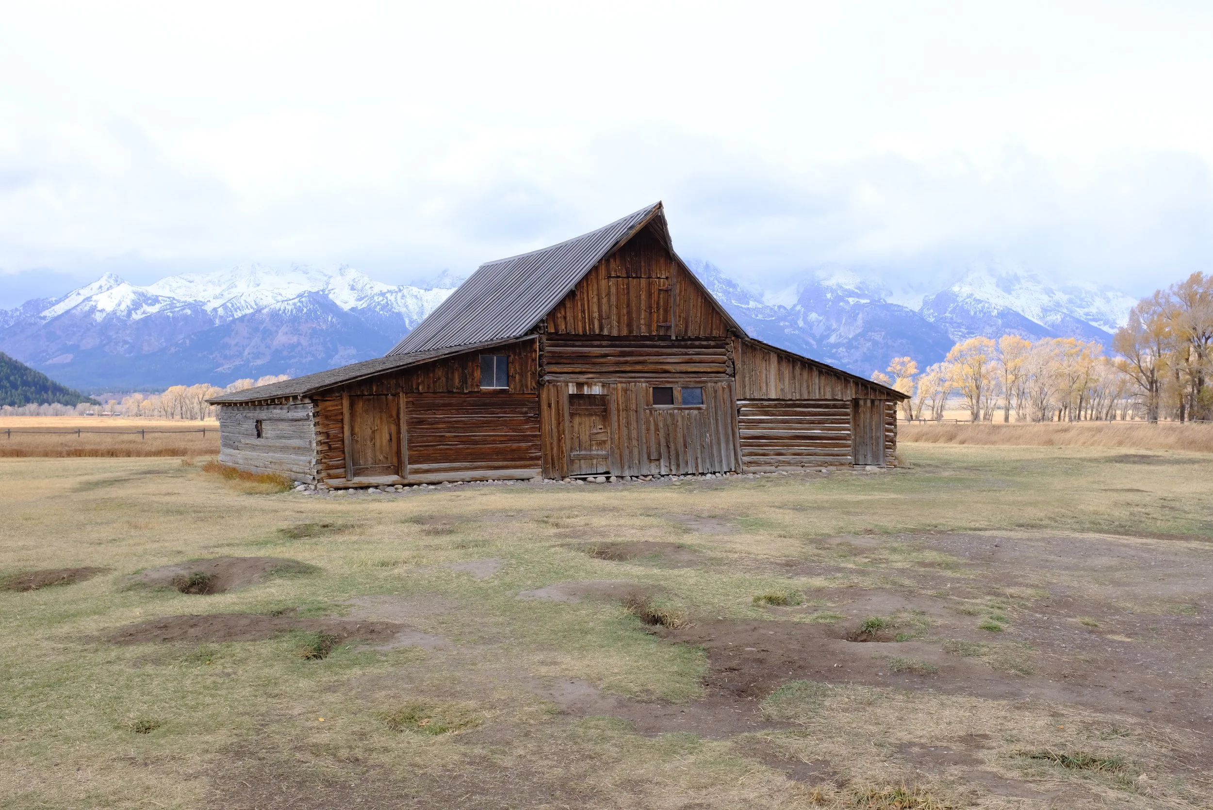
Afterward, I drove back south on Teton Park Road before making a left onto Highway 191 and heading north. Soon, I turned right onto Antelope Flats Road, which took me to Mormon Row. This historic district featured homesteads established by Mormon settlers in the 1890s, and some of their homes and barns, like the T.A. Moulton Barn, still stand today. Observing these buildings up close was fascinating and even surreal, especially with their “imperfections” such as their slanted walls which look as though they could collapse inward with just a gust of wind - talk about structural integrity! I did have to watch my step here, as there were plenty of holes in the ground; I presume these were burrows made by small animals.


I drove back to Highway 191 and headed back south toward Jackson. Once I reached the town square, I made a left onto East Broadway Avenue. I took this road straight down to the National Elk Refuge, a nature preserve serving as a sanctuary for one the nation’s most significant elk herds. I turned onto National Elk Refuge Road and drove north for several miles, hoping to see these magnificent creatures. However, much like my experience on the Moose-Wilson Corridor, I did not spot a single elk - though I did see a couple pronghorn grazing in the fields along the road. While driving on this road did afford splendid views of the Tetons, there wasn’t much else to see. Eventually, as the road got bumpier and narrowed, I turned around and returned to Jackson, feeling underwhelmed.

Back in Jackson, I drove over to the Rustic Inn Creekside Resort & Spa to check into my cabin. Parking here was a little tight but manageable, and I was very impressed with my cabin. As I was settling in, I called the Gun Barrel Steak & Game House to put in my takeout dinner order. I was hoping that their Mixed Game Grill (a trio of elk steak, bison prime rib, and venison bratwurst) was available, but they were not serving it tonight. I had a feeling this would be the case, so I already knew what my backup choice would be - the elk chop with sides of green beans and wild rice. ‘Since I didn’t see elk today, I may as well eat one,’ I thought. Half an hour later, I was heading across town to the restaurant. It seemed like a popular spot, as it was packed inside. I picked up my order and returned to my cabin to eat. The elk was good; cooked medium rare, it wasn’t as gamey as I had anticipated, though I didn’t like how the meat stuck to the bones. The two sides complemented the elk quite well.
I went to bed earlier than normal, as the next day would start early start for me.
Day Two: Grand Teton National Park
I woke up at 5:30am, washed up, and wolfed down a simple breakfast. A quick Google search showed that the sun would rise at about 7:30am, which meant I had to hit the road soon. I drove north on Highway 191 into the park, the morning still dark and quite cold.


After about 20 minutes, my GPS indicated that I take a left onto the unpaved Schwabachers Landing Road. It took me down to a small parking lot… which was packed with cars. I cursed, realizing that many other people had the same idea I did: take sunrise photos at Schwabacher Landing, a scenic area next to Snake River. I parked outside the lot’s restroom stall, got out, and pulled out my camera gear. I quickly made my way down a path alongside the river, where no less than 20 people had set up their cameras and were standing around. I found a decent spot to set up my tripod and asked a nearby photographer if I was in the way of his shot. He said I wasn’t, but I felt guilty when I saw him adjust his tripod after I had set up mine. I took a few test shots, and it was just a matter of waiting for the sun to slowly brighten the Tetons. Finally, after about 20 minutes of waiting, the sun’s light broke onto the mountain peaks in a spectacular display of pink, orange, and yellow - and the river’s surface below reflecting it. For the next 15 minutes, all I could hear were camera shutters going off and murmurs of how breathtaking the view was. It truly was magical, although I wished that I had chosen a better spot to shoot from when looking through my photos - I wanted more of the river and less of the river bank.


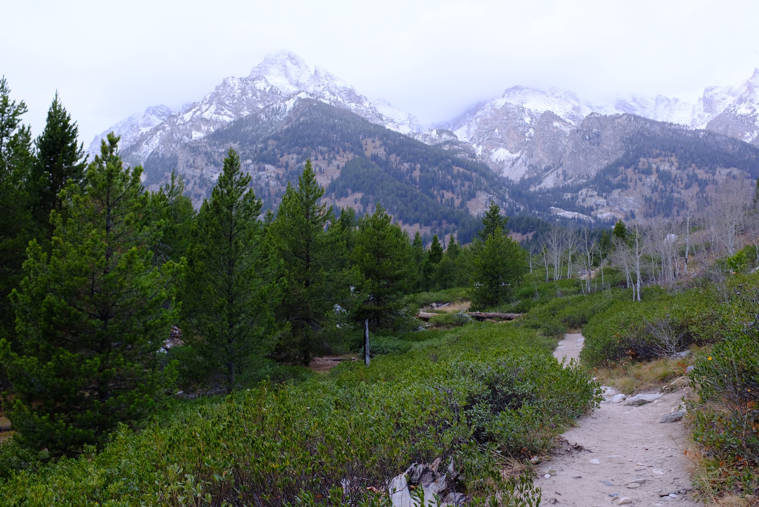


I returned to Highway 191, headed south, and then turned right onto Teton Park Road. 10 minutes later, I turned left into a parking lot for the Taggart Lake trailhead. This hike, the Taggart Lake Loop, would be my first in Wyoming. I had downloaded the trail map onto my phone using the AllTrails app, and as I hiked, it showed me where to go and turn. Starting from the parking lot, the trail begins as a gravel road but smooths out after a quarter mile. I crossed a couple bridges over small creeks, and the path continued into various woods that were sometimes ominous, sometimes innocuous. The trail gradually gains elevation for the first mile before plateauing for three-quarters of a mile. About a mile and a half in, I reached Taggart Lake, and its emerald-colored waters were simply beautiful. I rested here for nearly 20 minutes, walking along the water’s edge and snapping photos. I felt a small pang of regret when I turned my back on the lake, but I had to trek on and experience the most difficult part of the hike. I was still gaining elevation, but there were two sharp inclines that left me gassed (I was not in good shape). However, once I finished the second mile of this hike, it was almost all going downhill (literally) from here back to the parking lot. In all, this four-mile hike took me just over two hours to complete, and it was one of my favorite hikes over the course of my road trip.


I wasn’t done with hiking yet. After resting at my car and changing out of a now-sweaty shirt, I drove north on Teton Park Road and made a left into the parking lot for Jenny Lake. While I would be seeing a bit of this lovely lake, it was just one part of the hike I was going on: the Moose Ponds Trail. The two ponds that this hike loops around was noted to be a watering ground for various wildlife, including - of course - moose. From the parking lot, I went down one of the Jenny Lake Trail paths leading to a bridge next to Jenny Lake Boating. I crossed the bridge and continued down the trail, admiring the lake’s vastness. About a mile into the hike, the trail diverges, and a trail marker indicated that I go left for the ponds. After a brief climb, the ponds came into view, and alas, not a moose to be seen. As I trekked around the ponds, I did find evidence of beaver activity and did notice a dam in one of the ponds, though I didn’t see the animals themselves. After the ponds were well behind me, I noticed that the AllTrails map for this hike was weird, as it took me off the trail at around the two-mile mark and through a field, even though there didn’t seem to be a path visible. I became frustrated because not only could I see the trail I had been on some distance away, it seemed to be a more direct and logical route to the parking lot. Instead, here I was, walking through grass that nearly came up to my knees, wondering whether I would be ambushed by a bear or wolves hiding in the brush - and it had started raining. I eventually made it to the lot, and while this three-mile hike was easy, I thought it was mapped poorly and in all, not very enjoyable.


My plan was to hike more, but I had to change out of my shirt again since it was soaked with sweat. I had no more spare shirts with me, so my upper layer of clothes ended up being a sweater and a raincoat. Jenny Lake has a visitor center as well as a store nearby, so I thought about buying a shirt from there, but they were both closed. With the weather still being cold, I decided to call quits on hiking any further. Thus, I headed north on Teton Park Road and made a left onto Jenny Lake Road, on the opposite side of Jenny Lake. This road led to String Lake, located just above Jenny Lake. After finding a parking spot, I waffled around the area, mostly walking along the lake’s edges and admiring how the Teton Range’s peaks rose into the clouds above. As much as I wanted to explore further, I didn’t like to be out in the rain for too long, so I headed back to my car.

I drove north on Teton Park Road until it met Highway 191, and I continued my course on it. I kept my eyes peeled for any wildlife sightings, and I was lucky to spot another mule deer - but this time, a buck! Luckily for me, there was a parking lot available right after I saw it, so I quickly pulled into there, parked, and then quickly slunk back down the road, camera in hand, approaching the buck to take a photo. I guess a few passing cars and some other tourists in the parking lot knew that I had seen something, because a couple people started following me, holding their own cameras. The buck didn’t seem alarmed, as it continued grazing - allowing us to snap a few photos - before disappearing into the brush.


My northern drive on Highway 191 ended at Jackson Lake Overlook, a small rocky beach off the shores of the magnificent Jackson Lake. That I couldn’t even see where the far side of the lake ended made me feel minuscule. I wished the day wasn’t so overcast so I could see the peaks of the Teton Range, but I had to admit that it lent an almost otherworldly sense to them - who was I to bear witness to them?

I headed back south on Highway 191 and stopped at the Upper Willow Flats Overlook, a scenic and wildlife viewing spot. From here, I could see not only the near-inescapable Teton Range, but also the shores of Jackson Lake across the meadows before me. I walked down a small trail to a road meant for off-road driving, but ventured no further. No signs of wildlife, unfortunately (and almost predictably), but I was drawn by the small pops of green that remained in the autumnal landscape.


Next stop, Oxbow Bend. Here, one of Snake River’s meanders, or curves, has been shaped by erosion and soil deposits, resulting in its crescent shape. On a clear, autumn day, people can take photos of the river, reflecting Mount Moran (which dominates the northern section of the Teton Range) and the brilliant symphony of orange, red, and yellow. Today, being overcast and windy, was decidedly not that day. Since most of the trees in the area were still green, I suspected that I arrived too early to see the leaves fully change colors. Still, as I walked along the river’s muddy banks, I was thankful to see some autumnal colors as well as a collection of various water fowl.
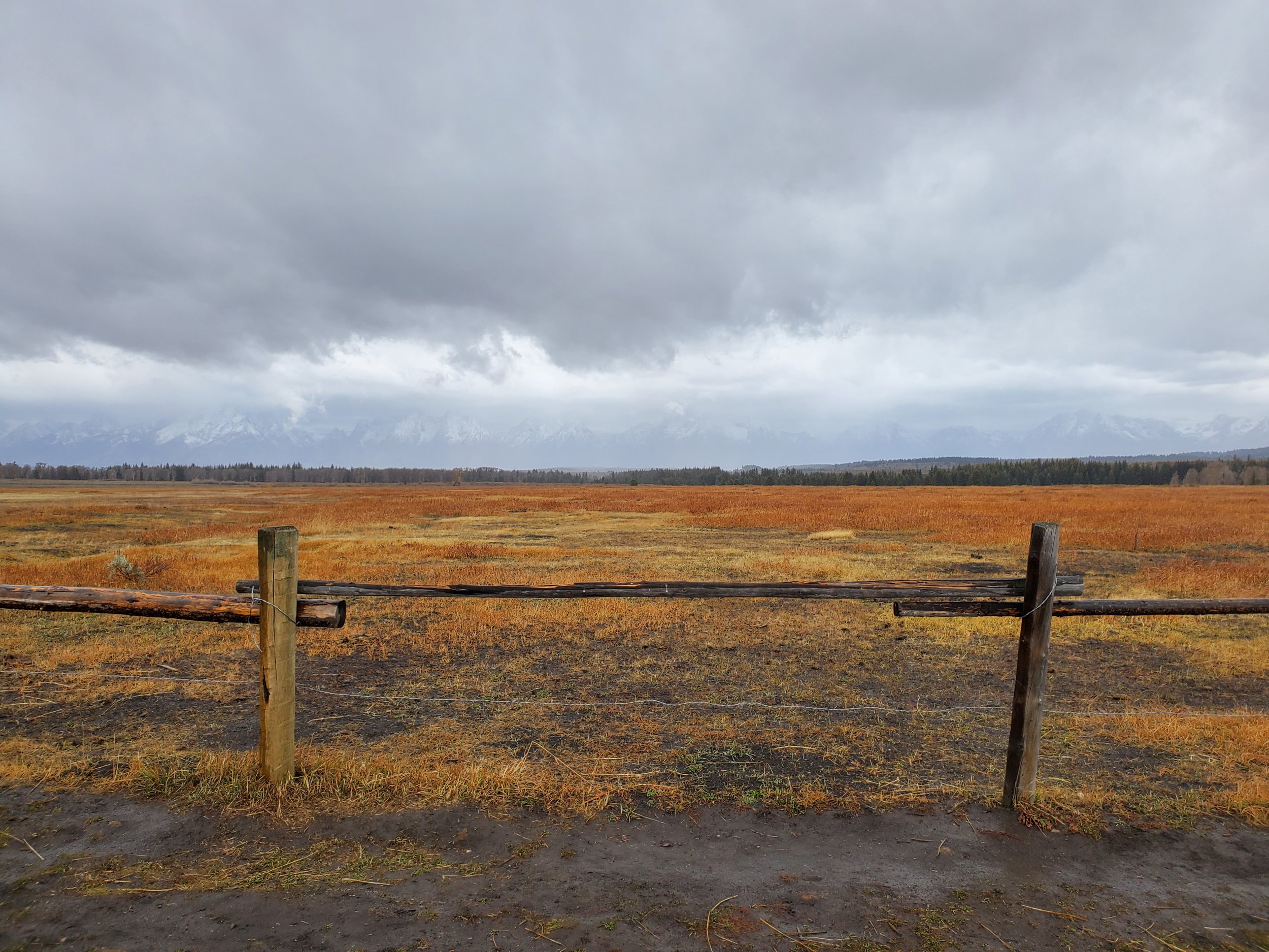
My visit to the National Elk Refuge netted zero elk sightings the day before, so I figured that the Elk Ranch Flats Turnout would be the last best chance I had to see these animals - not just in Teton County, but possibly even the state. Bison, elk, and pronghorn are known to graze in these fields, but I ended up seeing none of these. This spot did feel oddly transportive; the fence looked as though it was built in the early 20th Century before the Great Depression, and if it weren’t for the cars zooming by, I would’ve thought I had been transported to that era.


I next headed to the J.P. Cunningham Cabin. From Highway 191, I got off onto a road leading to a small parking lot for the site. From there, I walked down a short trail until I arrived at the cabin, which was built in the late 1880s. I was able to enter the structure and see what remained, though there wasn’t much besides a bench. The slanted design of the cabin reminded me of the buildings I saw at Mormon Row yesterday, and they lent me a great opportunity to take interesting shot compositions of the Teton Range.


Highway 191 runs alongside Snake River, and it seemed fitting that Snake River Overlook was the last stop I would make in the park. I had started my day’s drive to see the sun rise, and I wanted to see it set at the end. When I pulled into the parking lot, I still had over an hour until sunset, so I ended up reading a book, eating snacks, and trying to stay warm in the car. When the time came, I got out and walked along the overlook, taking photos. Because it was overcast, the sun was just a small sliver in the sky, but it seemed to nestle just among the Teton Range’s peaks.


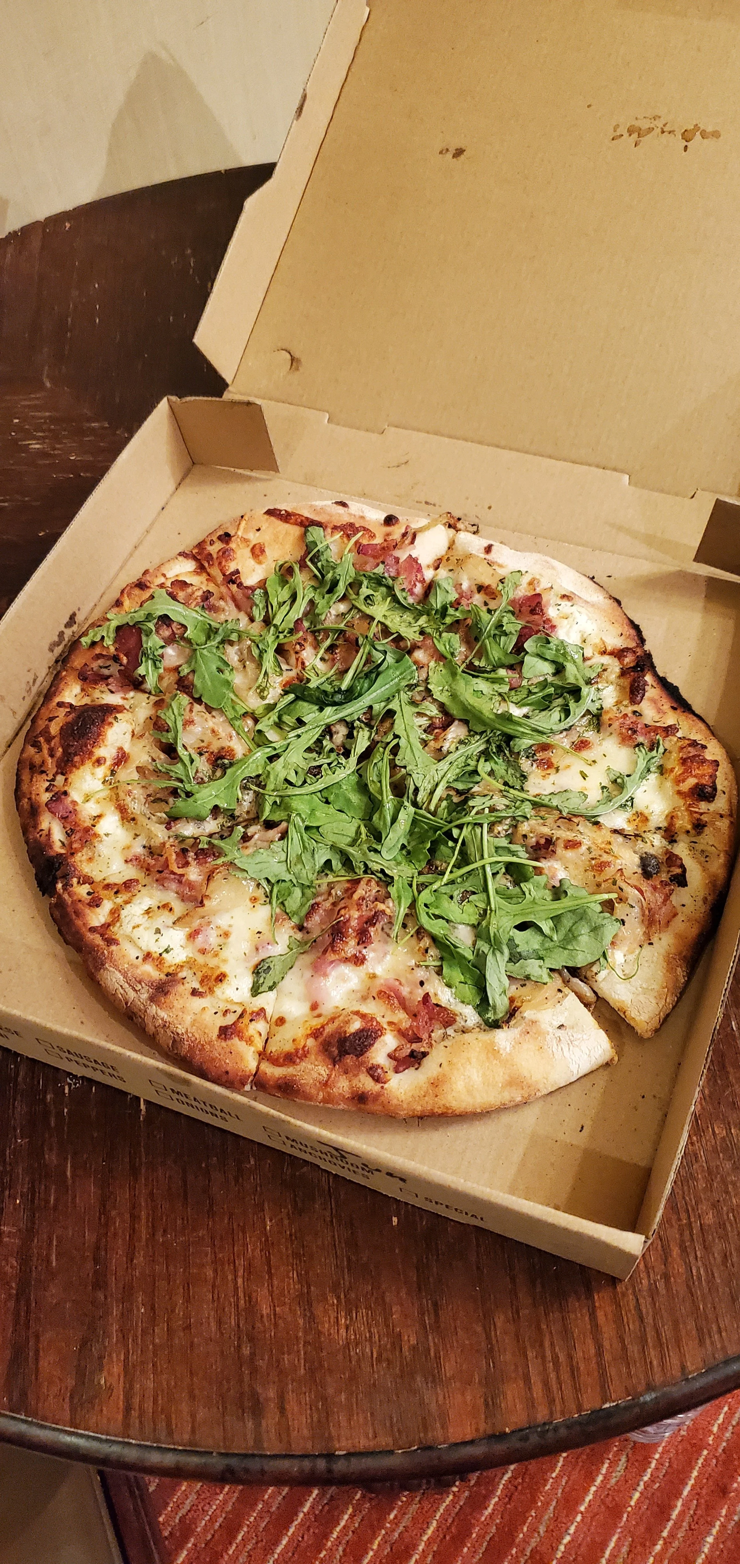
Upon entering my cabin, I turned up the thermostat and put on a fresh shirt, throwing the still-sweat-soaked shirts into my laundry bag. I was famished, having not eaten a proper meal all day. I called Hand Fire Pizza to put in my dinner order, washed up, and then was back out the door. I could have walked to the pizzeria, but I decided that I didn’t want to do so in the cold, especially if it rained. As I parked near the town square, I couldn’t help but be drawn in by the pink-purple lights from one of its antler arches. After I took a quick photo, I trudged up to the pizzeria, which was hard to miss due to its bright neon lights. The building was once the Teton Theater, and it had since been converted to a restaurant. In my very brief time inside, it was very cool seeing how this space had been repurposed. Back in my cabin, I ravenously ate The Chew-baca: a pizza with herbed ricotta cheese, bacon, caramelized onion, fresh arugula and a spicy Slide Ridge honey drizzle. This excellent pizza was just what I needed after being cold for most of the day, matched only by the hot shower I took afterward before falling asleep.
Day Three: Pinedale


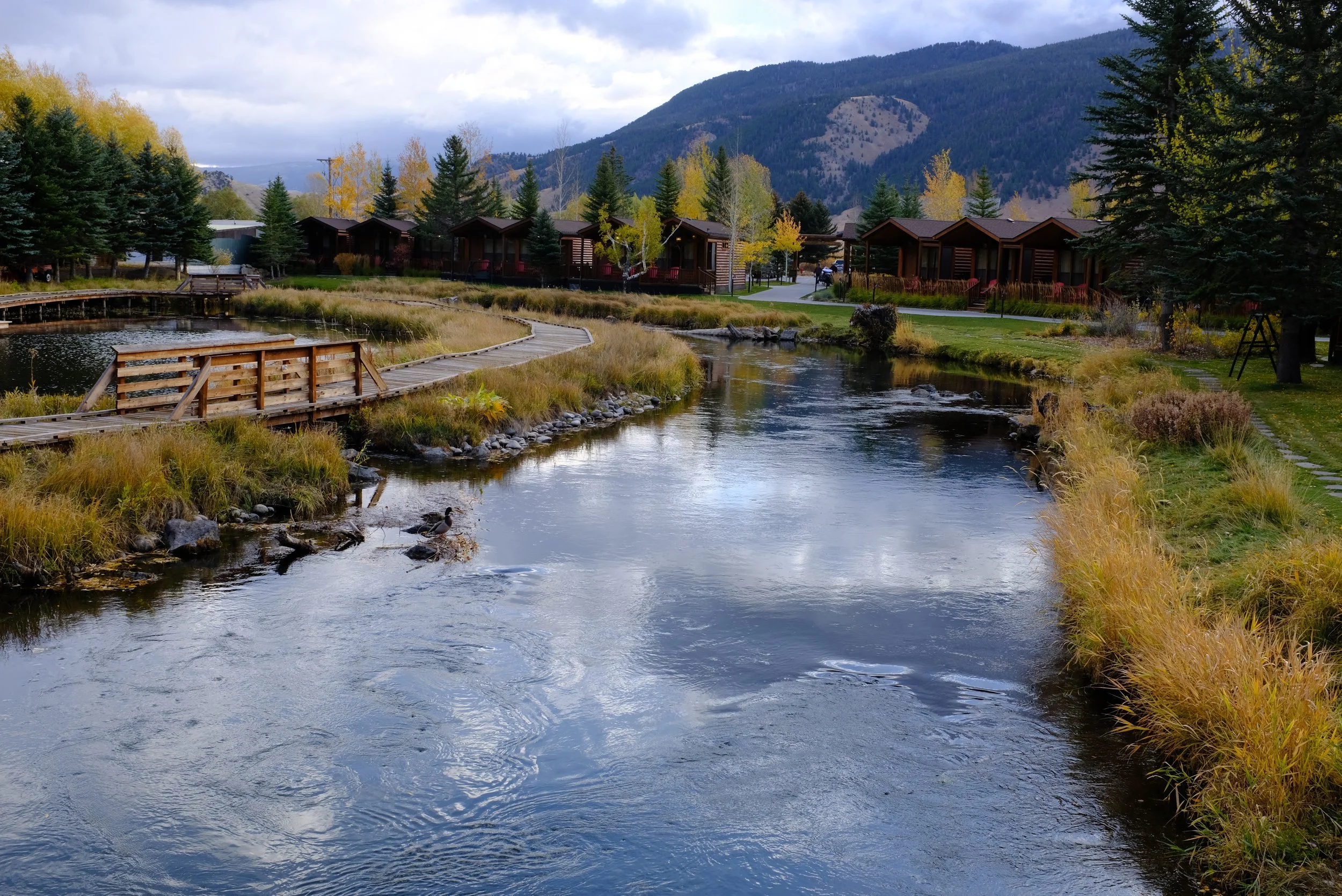
After waking up, I set about packing my things, as I was checking out in a few hours. After I had done so, I suddenly remembered that the Rustic Inn offered a complimentary breakfast to guests. I called the front desk to inquire, and the staff member told me to come by the bar and bistro. Upon entering, I was given a breakfast burrito and salsa, and I ate back in the cabin. While eating, I realized I had yet to properly explore the site, so I walked past the parking lot and cabins on a road which took me to Flat Creek, which runs into the town. The inn has a bridge crossing the creek to private backyard with fire pits, a tepee, a small banquet hall-like building, and a walkway that looped around a small nature preserve. I was very impressed, and I wished that I wasn’t in a pandemic so I could take better advantage of these amenities. As I checked out of my cabin, I resolved to come back one day.
After brief stops at the town’s Albertsons for supplies and McDonald’s (I was still hungry), I drove south on Highway 191. My destination was Pinedale, about 80 miles away.
Upon my arrival, I had several hours of free time before I could check into my cabin. Originally, I had planned to hike, but a part of me wanted to check out this seemingly sleepy town. I noticed a sign for the Sublette County Visitor Center, so I pulled into the parking lot and popped my head in. I was determined to see moose, so I asked the employee there where I could see some. As I was asking that question, another employee overheard me and said he nearly drive into one the other night. As they were listing off potential locations, I was starting to fancy my chances of seeing moose here. I also asked them about scenic drives nearby, and they gave me a map for a scenic drive that started close to where I would be staying for the night.

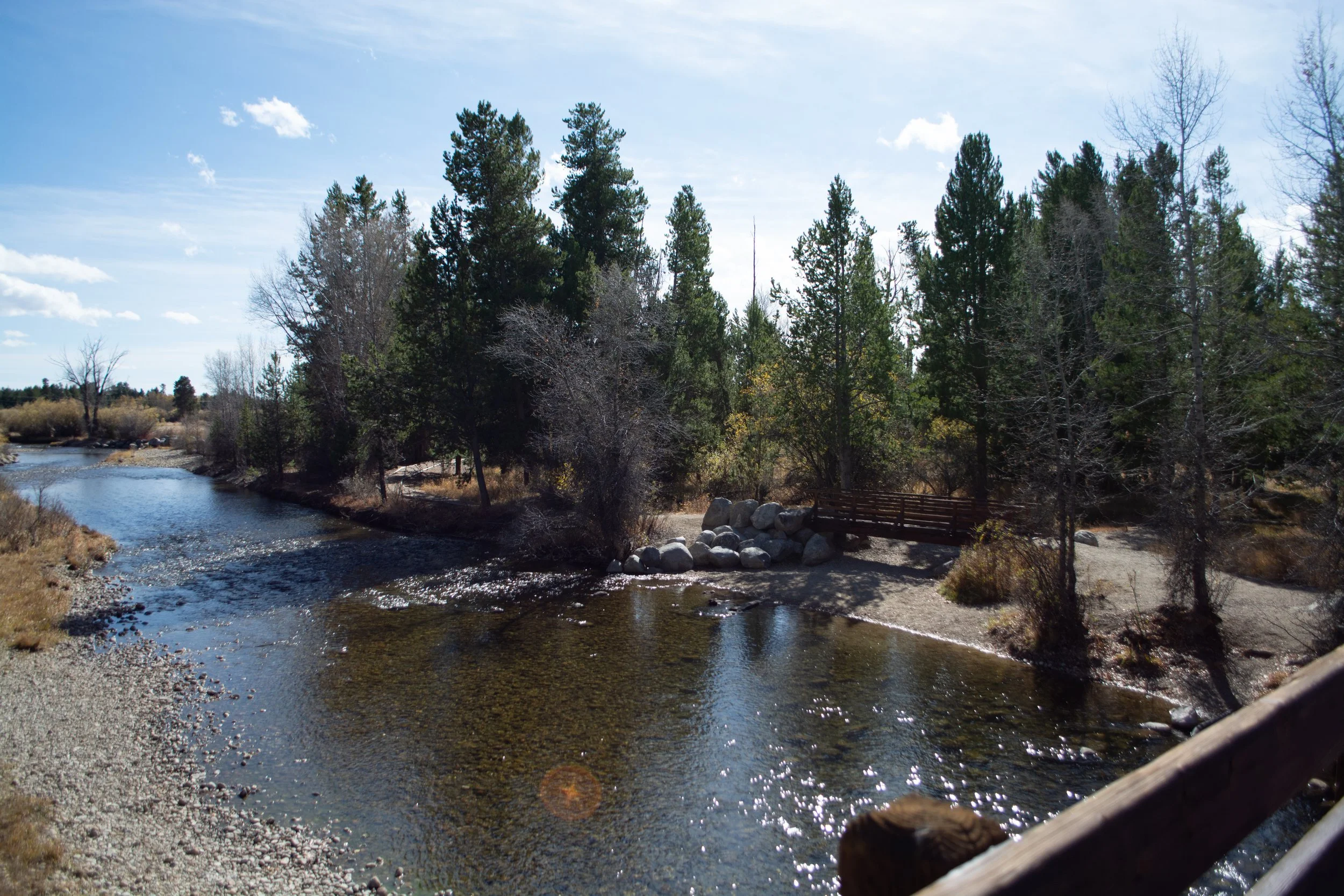

I drove over to Boyd Skinner Park, which is located in a neighborhood just south of Highway 191 (also known as Pine Street). There are a couple parking spots off of where Lake Avenue and Park Loop meet, and from there, I crossed a small bridge that crosses over Pine Creek. On the other side of the bridge, several trails run alongside the creek and into several residential areas. I found it to be a nice place to get a brisk, easy walk in, and that day, it was quiet.


When returning to the bridge, I spotted movement on the other side near one of the trails, but it wasn’t moose - instead, it was several mule deer. I started taking photos before I noticed a man walking along the edge of the creek on the other side with his dog, unaware of the deer but getting closer. He noticed me and waved, and I tried signaling to him that he was approaching wildlife. I wasn’t sure if he understood, but as he entered the area with the deer, he saw them and beckoned his dog along, and they passed by. I quickly crossed the bridge and got within a respectable distance of the deer, taking several more photos. As I headed back to the car, I ran into the man and started conversing with him. He gave me useful tips about approaching wildlife and spots to check out. As he was speaking, I couldn’t help but notice that he had a sidearm strapped to his belt. ‘Ah,’ I thought. ‘Looks like Wyoming allows open carry.’ As I continued listening, a morbid joke crossed my mind. ‘Thank God this guy doesn’t seem racist toward Asians. Otherwise, he might want to shoot me.’ I pushed that thought away, thanked him, and left.
Next, I drove down Country Club Lane from Highway 191, as the visitor center employees said that it was common for moose to make their way through the Rendezvous Meadows Golf Course. I couldn’t spot any from my car, so I left after only staying a few minutes.


On the north side of Highway 191, there is the American Legion Park. Here, I spent some time at the veterans memorial before walking down a path that runs along Pine Creek, still hoping to catch a sight of the elusive moose. Predictably, I saw none, and I returned to my car, feeling slightly miffed. Still, I liked the park. With its gazebo, canopied picnic tables, and trails, I imagined this was a popular space for locals.
Deciding to go on that scenic drive and hike, I drove east on Highway 191 and turned left onto Fremont Lake Road, heading north. After Fremont Lake came into view, the road became Skyline Drive, and I knew that I had started the Skyline Scenic Drive. Running all the way to Elkhart Park, this drive gives tourists views of Fremont Lake, Half Moon Lake, and the Wind River Range.


I knew I would get to see Fremont Lake during the return drive, so I kept my eyes peeled for Half Moon Lake. As it turned out, it was the first “stop”. The drive is mostly in the hills, so when I took a right onto Forest Road 743, I ended up driving on a decline toward the lake. It was fairly quiet, and the only evidence of human activity I saw were cars and homes on the lake’s western and southern shores. I opted to continue driving slowly on Forest Road 743, which runs along the lake’s northern shore. This eventually resulted in a dead end once I passed a nearby lodge, so I turned around and headed back to Skyline Drive. While being on this road offered some nice views, I thought they paled in comparison to the one I got when I pulled into a turnout area on Skyline Drive that overlooked Half Moon Lake.


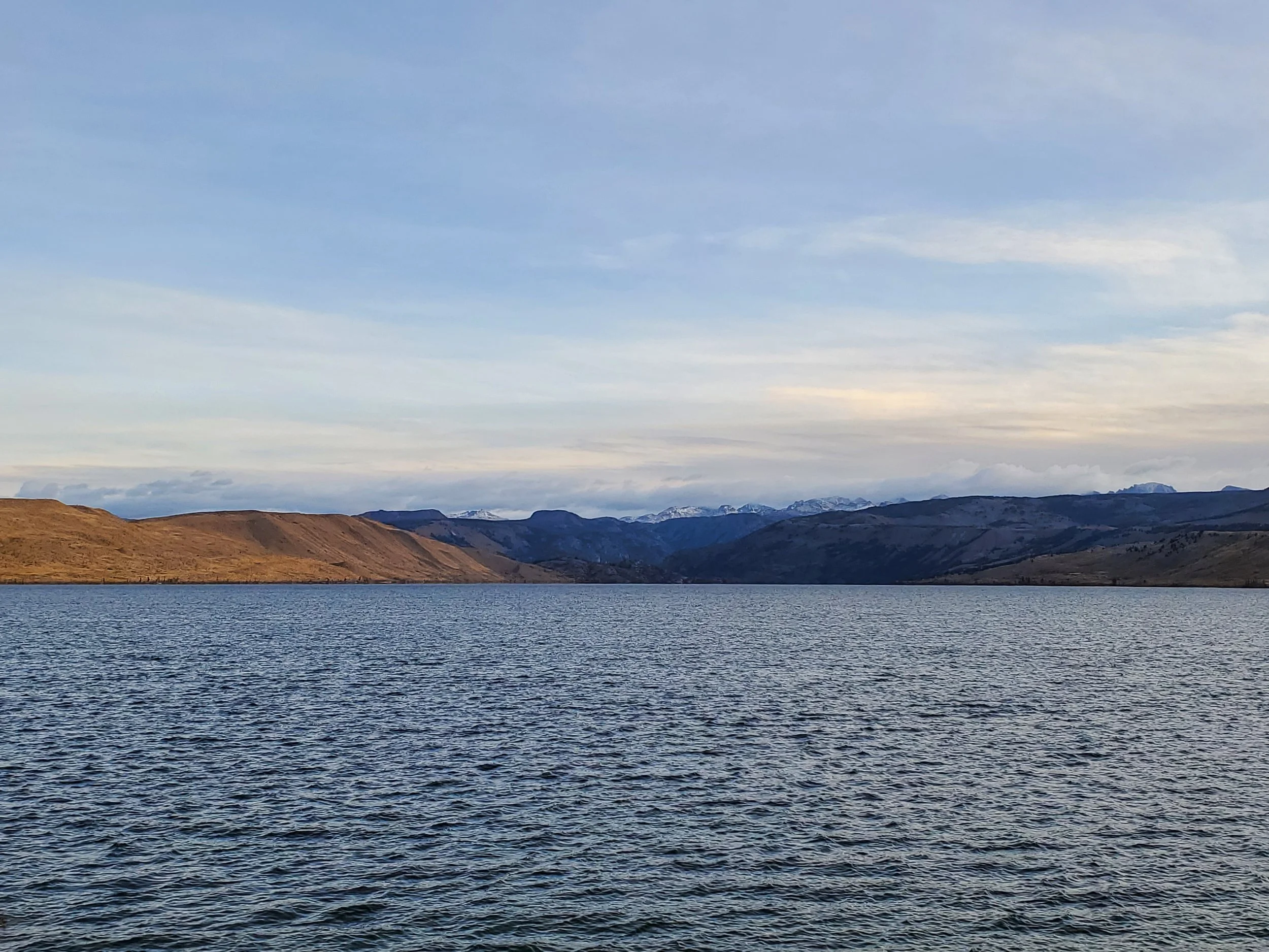
My intent was to hike to Photographers Point after reading about it in an article from The Guardian several years ago (see #19 in the link). However, I couldn’t help but notice how cold and windy it was up in the hills. By the time I arrived at Elkhart Park and the trailhead for the hike, I could feel the winds whipping into me hard, and I decided not to hike in these conditions. I still wanted to see the Wind River Range, so shortly after I turned around, I parked at a turnout that contained an interpretive panel that names the peaks of the Bridger Wilderness, including those of the range. I couldn’t quite get a good look of the range, so I climbed up the side of the road to get a better view. From there, I could see them, though my view was still somewhat obscured by the trees in front of me. I could also see the northern part of Fremont Lake - a testament to the lake’s immense size considering this point was over 10 miles away from where Skyline Drive had started.


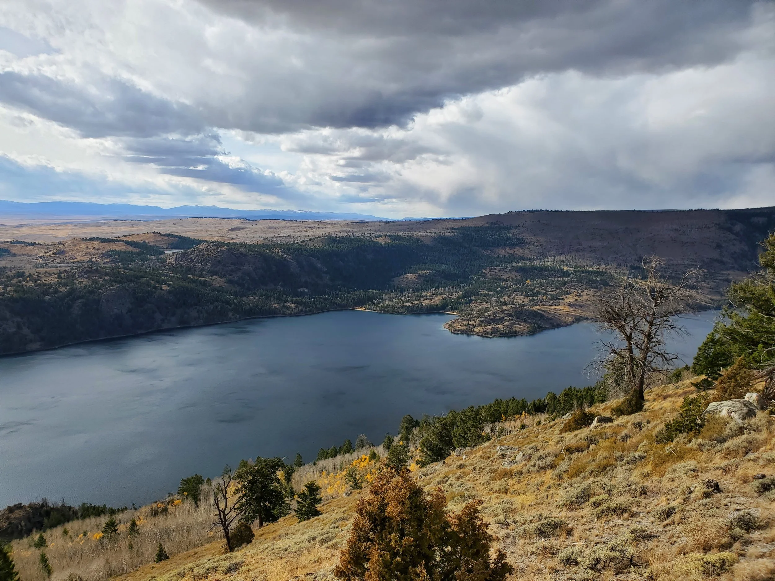

When driving back on Skyline Drive, I noticed a turnout area and parked there since I figured there was just more to see. Sure enough, I saw all of Fremont Lake (at least, as far as I could see) as well as what seemed like all of the Sublette County and beyond. Yes, Fremont Lake dwarfed me, but it in turn was dwarfed by everything else in the land, making me feel like a speck of dust. ‘This is what I was meant to see on this drive,’ I thought. I couldn’t dwell on this thought for too long since the wind started blowing incredibly hard to the point where I was nearly knocked over several times. I don’t doubt nature’s ability to overwhelm me, but I wasn’t sticking around to see how far that ability went; I quickly hustled over to my car.


By the time I had completed the Skyline Scenic Drive, I could now check into my cabin at Lakeside Lodge, located just yards away from Fremont Lake’s southern shore. While checking in, I asked the employee if it was normally this blustery in the area. She said it wasn’t, but they had seen their fair share of blustery days. The cabin was cozy, nicely organized, and most importantly, warm. I made sure to quickly move my things inside so I could settle down and relax after driving and walking around all day.

I searched on Yelp for nearby restaurants and saw that there was a Chinese restaurant named China Gourmet in Pinedale. I found myself craving Asian food, so I called in a takeout order consisting of BBQ pork fried rice and fried chicken wings before leaving for the restaurant, which was located almost across the street from the Sublette County Visitor Center. While I waited inside for my order to be ready, I wasn’t happy to see unmasked customers walking through the door - I surmised that Pinedale didn’t have a mask mandate like Jackson Hole did. Thankfully, my order was quickly handed to me, which meant I could leave the company of these people. Both the rice and the chicken were overcooked; I suppose there had to be a drawback when ordering food from the only Asian restaurant in town. After dinner, I thought about doing some astrophotography, but after sticking my head inside and getting a faceful of wind, I decided to stay inside and call it an early night.
Departure

When I went outside the next morning to put my things back in my car, I was surprised to see the winds had calmed down completely. Leave it to nature to pull its punches as I was about to leave! I stood out on my cabin’s porch for a bit before walking alongside the shore, listening to and enjoying the rhythmic sounds of the lake’s small waves as they rolled in. Since I was checking out early, I dropped off my key at the mailbox outside the lodge’s restaurant.


I drove west on Forest Road 749 before turning onto a road leading to the CCC Ponds. These ponds provide for various wildlife in the area, and visitors can see them when walking on the trails that loop around them. As you may have guessed, I had my fingers crossed for a moose encounter, and I knew deep down that this was my last best chance to see one. I spent about an hour walking around, watching the sun rise, and seeing some birds, but alas, I saw no moose - though I did see some rather large droppings that I think were left by mule deer or pronghorn. While driving back to Pinedale, I did catch a pair of pronghorn milling about.

I headed to Pine Coffee Supply, which was the best-reviewed coffee shop in town according to Yelp. I wasn’t keen on coffee at the moment, so I bought a cup of hot chocolate. Despite it being a bit early in the morning, there was already quite a number of customers inside, sipping their drinks and chatting amongst themselves.
I had a long drive ahead of me, as my plan was to drive all the way to the state’s capital of Cheyenne, over 350 miles away. And yet, my stubborn ass drove back over to Boyd Skinner Park and walked on the trails again, holding out on the hope that I would see moose. However, the only animal I saw in my short time at the park was a cat sitting atop a fallen log. Admitting defeat, I returned to Highway 191 and took one last look at the town before driving south, grateful for the experiences I had in this part of Wyoming and looking forward to what I would experience during the rest of my trip.
I enjoyed my experiences in western Wyoming, and I do plan on coming back to these areas again in the future. When I do return, I hope I can stay for a longer period so I can experience more of what these areas have to offer. When I do return, I hope the weather will be better and the skies not as overcast. And yes, when I do return, I hope there will be moose (and bear, and elk) that I can finally see.